HellishDollars

Sunday, August 16, 2009

0 comments

Inle Lake


A wonderful watery world of floating gardens, stilted villages and crumbling stupas, Inle Lake is an absolute must. Mountains tumble down towards the lakeshore, blurring the distinction between heaven and earth. For many travellers, Inle is heaven on earth, a place to while away the days canoeing, cycling and walking through the lush countryside. The Intha people are famous for their leg rowing, although these days many just turn it on for the tourists. There is even a monastery where meditating monks have taught the cats to jump – that’s enlightenment for you. Inle deserves to be savoured, not rushed, and many travellers end up staying for longer than they expected.

Wednesday, July 29, 2009

0 comments

Kuthodaw Pagoda


literally Royal Merit, and formally titled Mahalawka Marazein is a Buddhist stupa, located in Mandalay, Burma (Myanmar), that contains the world's largest book. It lies at the foot of Mandalay Hill and was built during the reign of King Mindon. The stupa itself, which is gilded above its terraces, is 188 feet (57 m) high, and is modelled after the Shwezigon Pagoda at Nyaung-U near Bagan. In the grounds of the pagoda are 729 kyauksa gu or stone-inscription caves, each containing a marble slab inscribed on both sides with a page of text from the Tipitaka, the entire Pali Canon of Theravada Buddhism.

Royal merit

Mindon Min had the pagoda built as part of the traditional foundations of the new royal city of Mandalay in 1857. He was later to convene the Fifth Buddhist Synod in 1871, but wanted to leave a great work of merit by having the Tipitaka set in stone for posterity, meant to last five millennia after the Buddha. Construction began in 1860, its hti (umbrella or crown) mounted on 19 July 1862, and the inscriptions were laid open to the public on 4 May 1868. They were arranged in neat rows within three enclosures, 42 in the first, 168 in the middle and 519 in the third. One more stands at the southeast corner of the first enclosure making it 730, and this stone records how it all came into being. Thirty four brick zayats (rest houses) stood all around except on the east side of the pagoda.

A late Konbaung period frieze at the southern approach

The main entrance is from the south through massive but open teak doors ornately carved with floral designs, scrolls, and Deva Nats. It is a covered approach or saungdan as in most Burmese pagodas with frieze paintings under the roof. Between the rows of stone-inscription stupas grow mature star flower trees (Mimusops elengi) that emanate a jasmine-like fragrance to the entire complex. Burmese families may be seen having a picnic in the cool shade under these trees, picking the flowers to make star flower chains for the Buddha or to wear in their hair, or the children playing hide and seek among the rows of stupas. On the southwest inner terrace is one very old tree believed to be 250 years old, its low spreading boughs propped up by supports.


Annexation and desecration

One of the stone inscriptions, originally in gold letters and borders, at Kuthodaw

After the annexation of Mandalay by the British in 1885, the walled city with Mandalay Palace became Fort Dufferin, and troops were billeted all around Mandalay Hill in the monasteries, temples and pagodas. They became off-limits to the public and Burmese were no longer allowed to visit their religious sites. One revenue surveyor called U Aung Ban then came up with the idea of appealing direct to Queen Victoria since she had promised to respect all religions practised by her subjects. To their amazement and great joy the British queen promptly ordered the withdrawal of all her troops from religious precincts in 1890. This however turned to great sadness when they found that the pagoda had been looted from the hti, left lying on the ground stripped of its bells, gold, silver, diamonds, rubies and other precious stones, down to the Italian marble tiles from its terraces. The zayats lay in utter ruin and the bricks had been used to build a road for the troops. All the brass bells from all the kyauksa gu stupas were gone, 9 on each making it 6570 in total. The gold ink from the letters as well as the sides and top of each marble slab had also disappeared. All the biloos along the corridors had lost their heads, and the marble eyes and claws from the masonry chinthes gone.

Saturday, July 25, 2009

0 comments

Naypidaw

Naypyidaw also spelled Nay Pyi Taw; pronounced [nèpjìdɔ̀]) is the capital of Burma. Nay pyi daw means "Great City of the Sun", but is also translated as "abode of kings". On 6 November 2005, the administrative capital of Burma was officially moved to a greenfield site 2 miles (3.2 km) west of Pyinmana, and approximately 200 miles (320 km) north of Yangon. The capital's official name was announced on 27 March 2006, Burmese Armed Forces Day.

During World War II, Pyinmana was the base of the Burma Independence Army (later renamed and reorganized into the Burma Defence Army by the Japanese). It was in Pyinmana that the army and its officers were trained. Later the Burma National Army changed sides, aiding the Allies with guerrilla warfare, and the operations were seen as a victory by the Burmese. Pyinmana became an icon in the Burmese Army where it was seen as the place where 'superior invaders' were defeated by the Burmese.

Naypyidaw itself has a short history, having been founded in late 2005. The military government began moving government ministries from Yangon to Naypyidaw on 6 November 2005 at the astrologically auspicious time of 6:37 a.m.[5] Five days later, on 11 November at 11 a.m., a second convoy of 1,100 military trucks carrying 11 military battalions and 11 government ministries left Yangon. The ministries were expected to be mostly in place by the end of February 2006; however, the hasty move led to a lack of schools and other amenities which separated the government employees from their families for the time being. Military headquarters were located in a separate compound from the government ministries, and civilians have been banned from entering either. Vendors are restricted to a commercial zone near the government offices. For official works, officers use "NPT" as a synonym.

Naypyidaw is more centrally, and strategically, located than the old capital Yangon. It is also a transportation hub located adjacent to the Shan, Kayah and Karen states. It was felt that a stronger military and governmental presence nearby might provide stability to those chronically turbulent regions.[citation needed] The official explanation for moving the capital was that Yangon had become too congested and crowded with little room for future expansion of government offices.

However, this explanation seems illogical and unreasonable to most of Myanmar (aka Myanmar people). The moving of the capital has rather been considered a tricky political tactic by the government, possibly also a superstitious move as predicted by some monk. The move is also considered as one of the worst urban planning projects of the century. Indian journalist Siddharth Varadarajan, who visited Naypyidaw in January 2007, described the vastness of the new capital as "the ultimate insurance against regime change, a masterpiece of urban planning designed to defeat any putative ‘colour revolution’ – not by tanks and water cannons, but by geometry and cartography".

On 27 March 2006, more than 12,000 troops marched in the new capital in its first public event: a massive military parade to mark Armed Forces Day—which is the anniversary of Burma's 1945 uprising against Japanese occupation. Filming was restricted to the concrete parade ground which contains three enormous sculptures—depictions of the Burmese kings Anawrahta, Bayinnaung and Alaungpaya who are considered the three most important kings in Burmese history. The city was officially named Naypyidaw during the ceremonies.[

Tuesday, July 21, 2009

0 comments

Myanmar Currency

The currency of burma is called Kyat. The currency is somehow volatile. Jumping up and down in rather big steps, changing the value within 1 week for 10% and more is not seldom. The Myanmar currency is not convertible and problem prone anyway.

Thursday, July 16, 2009

0 comments

Andaman sea

There is a archipelago in the Andaman Sea - in the eastern part of the Indian Ocean- with about 800 pristine islands, beaches, jungle, lush tropical vegetation inhabited by sea - gipsy turned into fisherman, pearl diver and amber collector. A similar situation with islands in the archipelago in Thailand is at Trang Archipelago, Surin Islands and Tarutao Islands.

It's the territory of the Salon or Sea Gypsies. What has happened amongst these islands since men first came to live and move amongst them, there is no record, and there never will be any now. Here and there only the curtain of the unknown is lifted for a passing moment. Their main, and it would seem their earliest, human interest centre in the colony of the Salon, which has made of these islands its last refuge.

To enjoy this adventure trip in real time you have to book a scuba diving live aboard trip at Phuket Thailand.

When or whence they came to the Andaman Sea, one can only guess ; and whether they had any human predecessors it is difficult even to conjecture.

But it is probable that they are an extremely ancient people,

kindred of that aboriginal stock which peopled the mainland before the advent of the Htai. The main body of these aborigines drifted away under the pressure of the Htai to the south, there to develop into the Malay race. A

fragment of them retreated to the shelter of the islands further down like Phuket island in Thailand ; others cut off from civilizing influences, they have made no progress, and too weak to face their adversaries, they have developed the nomadic life, the habit of few possessions, of flight at the sight of a stranger.

The attrition of time and the cruelty of man have worn away the race to its present proportions. It has too long bowed down its head, too long ceased to make any effort after greater things to have any future before it. The Malay who is of kin will acknowledge no relationship, and in times that are past he has been its most cruel oppressor. Myanmar or Burma and Malaysia have a long time common history from the colonial area, very close was the relation between Myanmar islands and Penang island in Malaysia.

The fire of Islam, which has molten the Malay into a people, has never warmed the aboriginal Salon. A great gulf of time must therefore separate them and these islands must have known the Salon for far more than a thousand years. Also the
Phi Phi islands in neighboring Thailand have a big sea gypsies community, in Thailand they call them Moken.

ISLAND VILLAGE THE MERGUI - MYEIK ARCHIPELAGO  MYANMAR BURMAAlmost the first account of the archipelago, written by a European traveler, is that of Caesar Frederick the Venetian. It has all the charm and interest of early travel ; and is best told in the language of his time.

" From the port of Pechinco," he says, " I went to Cochin, and from Cochin to Malaca, whence I departed for Pegu - Bago eight hundred miles distant, that voyage was to be made in twenty five or thirty days, but we were for months, and at the end of three months our Ship was without victual’s. The Pilot told us that wee were by his altitude from a city called Tenassiry - Tenasserim, a city in the Kingdome of Pegu - Bago, -today its around Ranong- and these his words were not true, but we were (as it were) in the middle of many Islands, and many uninhabited rocks, and there were also some Portuguese that affirmed that they knew the land. I say being amongst these rocks, and from the land which is over against Tenassary - Tenasserim, with great scarcities of victual’s, and that by the saying of the pylate and two Portugalles holding them firm that we were in front of the aforesaid harbor, we determined to go thither with our boat and
Islands Salon Sea Gypsy Lving on the Boat MyanmarIslands Salon Sea Gypsy Living on the Boat Myanmar movingfetch victual’s, and that the ship should stay for us in a place assigned ; we were twenty and eight persons in the boat that went for victual’s, and on a day about twelve of the clock we went from the Ship, assuring ourselves to be in the harbor before night in the afore said port ; wee rowed all that day, and a .

great part of the next night, and all the next day without finding harbor, or any sign of good landing, and this came to pass through the evil counsel of the two Portuguese that were with us

Wednesday, July 15, 2009

0 comments

Ayeyarwady River


The Ayeyarwady River or Irrawaddy River is a river that flows from north to south of Burma (Myanmar). It is the country's largest river (about 1350 miles or 2170 km long) and its most important commercial waterway, with a drainage area of about 158,700 square miles (411,000 km²).

Etymology

The Myanmarese name of Ayeyarwady (formerly transliterated as Irrawaddy) is derived from the ancient name of the river Ravi, Airavati, in the Punjab region, but through it's Pali, rather than its Sanskrit form. Airavati in turn is the name of the elephant mount of Indra, a minor Indian goddess. Elephants were in Indian mythology often a symbol for water

When transliterated literally from Myanmar spelling, the modern rivername comes down to Erawati. Due to the spreading of Buddhism in South-East Asia, some names in Myanmar, and to a lesser extent in other South-East Asian countries, are adaptations of Indian place names associated with Buddhism, e.g. Myawaddy (originated from Amaravati), Dvaravati, Ayuthia (originated from Ayoddhya or Ayujjha), Cambodia (originated from Kamboja). Erawati also belongs to this category, as it is also the ancient name of the river Ravi in Punjab". The ancient name was Airavati, in Sanskrit meaning

  1. ira -any drinkable fluid; a draught (especially of milk),...food, refreshment, ..vat...granting drink or refreshment,...name of a river in Panjab now called Ravi..
  2. Airavata (fr.ira-vat), a descendant of Ira-vat;....,N. of Indra’s elephant...(i) the female of Indra’s elephant; N. of a river,...;lightning...."

This is incompatible with Erawati, as it does not start with the vowel e. When the ancient name of the Ravi is rendered in Romanised Pali though, it is Eravati, which is compatible with the modern transliteration of the rivername, Erawati. The above means that not influence by Arabic (via Wadi), or Sanskrit (via Airavati) but Pali (via Eravati) has determined the name of the Irrawaddy.

The Irrawaddy gives its name to a dolphin, the Irrawaddy dolphin (Orcaella brevirostris), which is found in the upper reaches of the river and known to help fishermen who practice cast-net fishing. Though sometimes called the Irrawaddy River Dolphin, it is not a true river dolphin, since it is also found at sea.

[edit] Physiography

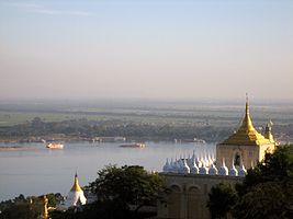
The Ayeyarwaddy River bisects the country from north to south and empties through a nine-armed Irrawaddy Delta into the Indian Ocean.

[edit] Source

It arises by the confluence of the N'mai and Mali Rivers in Kachin State Kachin. Both the N'mai and Mali Rivers find their sources in the Himalaya glaciers of Northern Myanmar, in the vicinity of 28° N . The eastern branch of the two, N'mai river, is the larger stream, but it is unnavigable because of the strong current whereas the smaller western branch, the Mali river, is navigable, despite a few rapids.

The town of Bhamo, about 150 miles (240 km) south of the Mali and N'mai river confluence, is the northernmost city reachable by boat all the year round although during the monsoons most of the river cannot be used by boats. The city of Myitkyina however lies 30 miles (48 km) south of the confluence and can be reached during the dry season.

Defiles

Between Myitkyina and Mandalay, the Irrawaddy flows through three well-marked defiles[11] :

  • About 40 miles (65 km) downstream from Myitkyinā is the first defile.
  • Below Bhamo the river makes a sharp westward swing, leaving the Bhamo alluvial basin to cut through the limestone rocks of the second defile. This defile is about 300 feet (90 m) wide at its narrowest and is flanked by vertical cliffs about 200 to 300 feet (60 to 90 metres) high.
  • About 60 miles (100 km) north of Mandalay, at Mogok, the river enters the third defile. Between Katha and Mandalay, the course of the river is remarkably straight, flowing almost due south, except near Kabwet[12], where a sheet of lava has caused the river to bend sharply westward.

This sheet of lava is the Singu Plateau, a volcanic field from the Holocene. This field exists of magma from the fissure vents and cover an area of about 62 km². The plateau is also known as Letha Taung.

Leaving this plateau at Kyaukmyaung, the river follows a broad, open course through the central dry zone - the ancient cultural heartland — where large areas consist of alluvium flats. From Mandalay (the former capital of the kingdom of Myanmar), the river makes an abrupt westward turn before curving southwest to unite with the Chindwin River, after which it continues in a southwestern direction. It is probable that the upper Irrawaddy originally flowed south from Mandalay, discharging its water through the present Sittoung River to the Gulf of Martaban, and that its present westward course is geologically recent. Below its confluence with the Chindwin, the Irrawaddy continues to meander through the petroleum producing city of Yenangyaung, below which it flows generally southward. In its lower course, between Minbu and Prome, it flows through a narrow valley between forest-covered mountain ranges—the ridge of the Rakhine Yoma Mountains to the west and that of the Pegu Yoma Mountains to the east

The Irrawaddy Delta

The delta of the Irrawaddy begins about 58 miles (93 km) above Hinthada (Henzada) and about 180 miles (290 km) from its curved base, which faces the Andaman Sea. The westernmost distributary of the delta is the Pathein (Bassein) River, while the easternmost stream is the Yangon River, on the left bank of which stands Myanmar’s capital city, Yangon (Rangoon). Because the Yangon River is only a minor channel, the flow of water is insufficient to prevent Yangon Harbour from silting up, and dredging is necessary. The relief of the delta’s landscape is low but not flat. The soils consist of fine silt, which is replenished continuously by fertile alluvium carried downstream by the river. As a result of heavy rainfall varying from 80 to 120 inches (3,000 mm) a year in the delta, and the motion and sediment load of the river, the delta surface extends into the Andaman Sea at a rate of about 165 feet (50 m) per year.
0 comments

Sagaing


Sagaing is the chief city and capital of Sagaing Division in Myanmar. It is located on the Ayeyarwady River, 20 km to the southwest of Mandalay on the opposite bank of the river.

Sagaing is a religious and monastic center, with numerous Buddhist monasteries. It briefly held position as a royal capital of Burma from 1760-1764.

The British-built 16 span Ava Bridge connects Sagaing with Mandalay, and tourists frequently visit Sagaing as a day trip. One tourist favorite located near the city is the Mingun Bell, claimed to be the world's largest ringing bell. Its weight of 55555 viss (approximately 90 metric tons) is engraved into the front side.

The city is home to the Sagaing Institute of Education and the Sagaing Education College.

People

0 comments

Yangon


Yangon(also known as Rangoon) is the largest city and a former capital of Myanmar. It is the capital of Yangon Division. Although the military government has officially relocated the capital to Naypyidaw since March 2006, Yangon, with a population of four million, continues to be the country's largest city and the most important commercial center.

Yangon's infrastructure is relatively undeveloped compared to those of other major cities in Southeast Asia. Yangon has the largest number of colonial buildings in Southeast Asia today. While many high-rise residential and commercial buildings have been constructed or renovated throughout downtown and Greater Yangon in the past two decades, most satellite towns that ring the city continue to be deeply impoverished.

Yangon is a combination of the two words yanand kounwhich mean "enemies" and "run out of" respectively. It is also translated as "End of Strife". "Rangoon" most likely comes from the British imitation of the pronunciation of "Yangon" in the Rakhine dialect of Burmese.

History

Yangon was founded as Dagon in the 6th century AD by the Mon, who dominated Lower Myanmar at that time. Dagon was a small fishing village centered about the Shwedagon Pagoda. In 1755, King Alaungpaya conquered Dagon, renamed it "Yangon", and added settlements around Dagon. The British captured Yangon during the First Anglo-Burmese War (1824–26) but returned it to Burmese administration after the war. The city was destroyed by a fire in 1841.

[edit] Colonial Rangoon (1852–1948)

Layout of colonial Rangoon, late 19th century
A colonial building in downtown Yangon

The British Empire seized Yangon and all of Lower Myanmar in the Second Anglo-Burmese War of 1852, and subsequently transformed Yangon into the commercial and political hub of British Myanmar. Based on the design by army engineer Lt. Alexander Fraser, the British constructed a new city on a grid plan on delta land, bounded to the east by the Pazundaung Creek and to the south and west by the Yangon River. Yangon became the capital of all British Myanmar after the British had captured Upper Myanmar in the Third Anglo-Burmese War of 1885. By the 1890s Yangon's increasing population and commerce gave birth to prosperous residential suburbs to the north of Royal Lake (Kandawgyi) and Inya Lake.[5] The British also established hospitals including Rangoon General Hospital and colleges including Rangoon University.

Colonial Yangon, with its spacious parks and lakes and mix of modern buildings and traditional wooden architecture, was known as "the garden city of the East." By the early 20th century, Yangon had public services and infrastructure on par with London.

Before World War II, about 55% of Yangon's population of 500,000 was Indian or South Asian, and only about a third was Bamar (Myanmarn).[7] Karens, the Chinese, the Anglo-Burmese and others made up the rest.

After World War I, Yangon became the epicenter of Burmese independence movement, with leftist Rangoon University students leading the way. Three nationwide strikes against the British in 1920, 1936 and 1938 all began in Yangon. Yangon was under Japanese occupation (1942–45), and incurred heavy damage during World War II. Yangon became the capital of Union of Myanmar on 4 January 1948 when the country regained independence from the British.

0 comments

Mandalay


Mandalay is the second largest city and the last royal capital of Burma. Located 445 miles (716 km) north of Yangon on the east bank of the Irrawaddy river, the city has a population of nearly 1 million, and is the capital of Mandalay Division.

Mandalay is the economic hub of Upper Burma and considered the center of Burmese culture. A continuing influx of Chinese immigrants mostly from Yunnan Province in the past twenty years has reshaped the city's ethnic makeup and increased its economic dynamism. Despite Naypyidaw's recent rise, Mandalay remains Upper Burma's main commercial, educational and health center.

Etymology

The city gets its name from the nearby Mandalay Hill. The name is likely a derivative of a Pali word although the exact word of origin remains unclear. The root word has been speculated as: "Mandala" (meaning, circular plains) "Mandare" (believed to mean "auspicious land"), or "Mandara" (a mountain from Hindu mythology).

When it was founded in 1857, the royal city was officially named Yadanabon, the Burmese version of its Pali name Ratanapura which means "The City of Gems". It was also called Lay Kyun Aung Myei (Victorious Land over the Four Islands) and the royal palace, Mya Nan San Kyaw (The Famed Royal Emerald Palace)

History

Plan of Mandalay Palace

[edit] Early history

Like most former (and present) capitals of Burma, Mandalay was founded on the wishes of the ruler of the day. On 13 February 1857, King Mindon founded a new royal capital at the foot of Mandalay Hill, ostensibly to fulfill a prophecy on the founding of a metropolis of Buddhism in that exact place on the occasion of the 2,400th jubilee of Buddhism.

The new capital city site was 25.5 square miles (66 km²) in area, surrounded by four rivers. The plan called for a 144-square block grid patterned citadel, anchored by a 16 square block royal palace compound at the center by Mandalay Hill. The 1020-acre (413-hectare) citadel was surrounded by four 6,666-foot (2,032 m) long walls and a moat 210 feet (64 m) wide, 15 feet (4.57 m) deep. Along the wall were turrets for watchmen with gold-tipped spires at intervals of 555 feet (169 m). The walls had three gates on each side, and five bridges to cross the moat. In addition, the king also commissioned the Kuthodaw Pagoda, the Pahtan-haw Shwe Thein higher ordination hall, the Thudhamma Zayats or public houses for preaching the Doctrine, and the library for the Buddhist scriptures. In June 1857, the former royal palace of Amarapura was dismantled and moved by elephants to the new location at the foot of Mandalay Hill although construction of the palace compound was officially completed only two years later, on Monday, 23 May 1859.

For the next 26 years, Mandalay was to be the last royal capital of the last independent Burmese kingdom before its final annexation by the British. Mandalay ceased to be the capital on 28 November 1885 when the conquering British sent King Thibaw and his queen Supayalat to exile, ending the Third Anglo-Burmese War.

0 comments

Pyin U Lwin


Pyin U Lwin or Pyin Oo LwinMLCTS=prang u: lwang mrui.), formerly Maymyo is a scenic hill town in Mandalay Division, Myanmar, located in the Shan Highland, some 67 kilometers (42 miles) east of Mandalay, and at an altitude of 1070 meters (3510 ft).

History

The town began as a military outpost established near a small Shan village with two dozen households [1] situated on the Lashio-Mandalay trail between Nawnghkio and Mandalay. In 1896, a permanent military post was established in the town and later, because of its climate, it became a hill station and the summer capital of British Burma. The establishment in Burma (civil, commercial and military) would move to Maymyo during the hot season to escape from the high heat and humidity of Rangoon. During British rule and through the 1970's, Maymyo had a large Anglo-Burmese population, but this steadily declined. During the Japanese occupation, as many Anglo's were concentrated in and around Maymyo, the Japanese incarcerated many of them for fear of their loyalty to the British very close to Maymyo. Today though, Maymyo still has one of the larger hold over populations of Anglo-Burmese in the country. The British named the location Maymyo, literally May's Town in Burmese, after Colonel May, a veteran of the Indian Mutiny and commander of the Bengal Regiment temporarily stationed at the location of the town in 1887. [1][2] The military government of Burma renamed the town Pyin U Lwin.

[edit] Demographics

The town has approximately 10,000 Indian and 5,000 Nepali inhabitants who settled in Maymyo during British rule. Today, Pyin U Lwin has a thriving Eurasian community, consisting mostly of Anglo-Burmese and Anglo-Indians.

[edit] Educational institutions

Maymyo was an important educational centre during colonial times, with the GEHSs (Government English High Schools), such as St. Mary's, St. Michael's, St. Albert's, St. Joseph's Convent, and Colgate, all based in the town. British settlers and colonial administrators sent their children to be educated here, both European and Anglo-Burmese children. The town was also the location of the various schools of military education open to all ethnicities.

It is today home to the Defence Services Academy (DSA) and the Defence Services Institute of Technology (DSIT). There is a large military presence in the town.

0 comments

White Elephant


In Burma , white elephants have been revered symbols of power and good fortune. The announcement by the ruling military regime of the finding of white elephants in 2001and 2002 was seen by opponents as being aimed at bolstering support for their regime. A total of four white elephants are currently (2006) to be seen in a pavilion on the outskirts of Yangon.
0 comments

Bago

History

The 177 ft (54 m) Shwethalyaung Buddha, constructed in 994 A.D. by King Migadepa

According to legend, two Mon princess from Thaton founded Bago in 573 AD. It was written in the chronicles that eight years after enlightenment, Lord Buddha along with his disciples flew around the Southeast Asian countries. On his return journey while crossing the Gulf of Martaban, which happened to be at low tide, he saw two golden sheldrakes sitting, female on top of male, on a peak of land protruding out of the sea just enough for a bird's perch. Viewing this strange phenomenon, he predicted to his disciples that one day a country where his doctrine would thrive would come into existence in this vast sea area. That part of the sea, when it was silted up and ready for habitation approximately 1500 years after the prediction, was colonized by Mons from the Thaton Kingdom. Thus, the Mons became the first rulers of this country known in history as Hongsawatoi (Pali Hamsavati). Other variations on the name include Hanthawaddy, Hanthawady and Handawaddy; and in Thai หงสาวดี Hongsawadi.

The earliest mention of this city in history is by the Arab geographer Ibn Khudadhbin around 850 AD. At the time, the Mon capital had shifted to Thaton. The area came under rule of the Burmese from Bagan in 1056. After the collapse of Bagan to the Mongols in 1287, the Mon regained their independence.

In Lower Burma, a Mon dynasty established itself first at Martaban and then at Pegu. During the reign of king Rajadhirat (1383–1421) Ava and Pegu were involved in continuous warfare. The peaceful reign of Queen Baña Thau (Burmese: Shin Saw Bu; 1453-72) came to an end when she chose the Buddhist monk Dhammazedi (1472-92) to succeed her. Under Dhammazedi Pegu became a centre of commerce and Theravada Buddhism.

From 1369-1539, Hanthawaddy was the capital of the Mon Kingdom of Ramanadesa, which covered all of what is now Lower Burma. The area came under Burman control again in 1539, when it was annexed by King Tabinshweti to his Kingdom of Taungoo. The kings of Taungoo made Bago their royal capital from 1539-1599 and again in 1613-1634, and used it as a base for repeated invasions of Siam. As a major seaport, the city was frequently visited by Europeans, who commented on its magnificence. The Burmese capital relocated to Ava in 1634. In 1740, the Mon revolted and briefly regained their independence, but Burmese King Alaungpaya (or U Aungzeya) sacked and completely destroyed the city (along with Mon independence) in 1757.

Bago was rebuilt by King Bodawpaya (1782-1819), but by then the river had shifted course, cutting the city off from the sea. It never regained its previous importance. After the Second Anglo-Burmese War, the British annexed Bago in 1852. In 1862, the province of British Burma was formed, and the capital moved to Yangon. The name Bago is spelt peh kou literally. The substantial differences between the colloquial and literary pronunciations, as with Burmese words, was a reason of the British corruption "Pegu".

In 1911, Hanthawaddy was described as a district in the Bago (or Pegu) division of Lower Burma. It lay in the home district of Rangoon, from which the town was detached to make a separate district in 1880. It had an area of 3,023 square miles (7,830 km²), with a population of 48,411 in 1901, showing an increase of 22% in the past decade. Hanthawaddy and Henzada were the two most densely populated districts in the province.

Bago, formerly Pegu, is a city and the capital of Bago Division in Burma (or Myanmar). It is located 50 miles (80 km) from Yangon and has a population of 220,000.

Hanthawaddy, as it was constituted in 1911, consisted of a vast plain stretching up from the sea between the To (or China Bakir) mouth of the Ayeyarwady River and the Pegu Yomas. Except the tract of land lying between the Pegu Yomas on the east and the Hlaing river, the country was intersected by numerous tidal creeks; many of which were navigable by large boats and some by steamers. The headquarters of the district was in Rangoon, which was also the sub-divisional headquarters. The second sub-division had its headquarters at Insein, where there were large railway works. Cultivation was almost wholly confined to rice, but there were many vegetable and fruit gardens.

Today, Hanthawaddy may be considered a district of the city of Bago.

0 comments

Ava


Innwa (Burmese: ; MLCTS: ang: wa. mrui.; formerly Ava) is a city in the Mandalay Division of Burma, situated just to the south of Amarapura on the Ayeyarwady River. Its formal title is Ratanapura (ရတနာပူရ), which means City of Gems in Pali. The name Innwa means mouth of the lake, which comes from in (အင္‌း), meaning lake, and wa (), which means mouth. Known as Ava to the British and A-wa (mouth) in Burmese, it evolved to its modern name Innwa.

History

Ava was capital of Burma from 1364-1841 founded by King Thadominbya on an artificial island at the confluence of the Ayeyarwady and the Myitnge created by digging a canal linking the two rivers [1]. Prior to this, Sagaing had been capital, but after Sagaing fell to the Shan, the court moved across the river to Ava. The kings of Ava set about restoring Burmese supremacy, which had disintegrated after the collapse of Pagan to the Empire founded by King Anawrahta in 1057.

A Burman Ava Dynasty (1364-1527) was eventually established at the city of Ava by 1364. Pagan culture was revived and a great age of Burmese literature ensued. The kingdom lacked easily defensible borders, however, and was overrun by the Shan in 1527.

The Kingdom of Ava was involved in continuous warfare with Tai (Shan) saophas to the north on the frontier with Yunnan. There were repeated Tai raids on the capital of Ava and Ava sent military northwards to attack Tai fiefdoms such as Mong Mao. The Ming dynasty that ruled China from the late fourteenth century often tried unsuccessfully to put an end to this warfare through traditional Chinese diplomacy. Ava occasionally became involved in the warfare between the Ming and Tai in Yunnan such as in the Luchuan-Pingmian Campaigns (1436-1449).

Following is the detail account of one of those affairs among Ava, Shans, and China in 15th century, recorded in details by Burmese Historian U Kala in his U Kala Mahayarzawindawgyi.

In the Burmese lunar year 774, the Christian year 1411, Shans from Mawtone Mawkel invaded the town of Myedu in upper Burma. King Mingaung of Ava sent an army of eleven corps led by the Crown Price Minyekyawzwa to repel the Shans. The huge army consisted of three hundred war elephants, four thousand strong cavalry, and eighty thousand strong infantry. Once Minyekywzwa reached Myedu he immediately attacked and destroyed the smaller army of Mawtone Mawkel brothers. As the brothers fled on horseback to China, Minyekyawzwa brought their families, elephants, horses, and many prisoners of war back to Ava.

A few months after Myedu war Minyekyawzwa marched down into Lower Burma and attacked Pegu. Riding the Pegu King Yarzardayit’s own war elephant called Bagamat, Thameinbayan, a son-in-law of Mon king, came out of Pegu and had a duel with Minyekyawzwa. But he was defeated and taken prisoner together with his elephant Bagamat. Minyekyawzwa then marched farther to Bassein and laid siege to the town. But Bassein was too strong to be taken. So the Burmese army marched to nearby Myaungmya and laid siege to the town. During the long siege, Minyekyawzwa took Thameinbayan and more than twenty high-ranking Mon prisoners of war back to Ava in eight fast boats along the River Irrawaddy. The upstream trip took eleven days. Minyekyawzwa stayed for only seven days in Ava and came back down to Lower Burma. The return trip downstream to the town of Dala across the river from Dagon (Rangoon) took only four nights and five days. His army then laid siege to the towns of Dagon and nearby Syriam.

Meanwhile, the fleeing Mawtone Mawkel brothers had reached China, where they begged the Chinese Emperor Uteebwa to help them to rescue their captured families now in Burmese hands. Chinese sent their General Erawaka with an army of two hundred war elephants, two thousand strong cavalry, and forty thousand strong infantry into Burma and reached Ava, then the royal capital of Burma. The Burmese army led by Minyekyawzwa then was waging a protracted war of attrition against Yarzardayit led Mons near Pegu in Lower Burma and couldn’t come back to relieve the capital Ava. The invading Chinese surrounded Ava and sent in an ultimatum demanding that Burmese either release the captured families of Mawtone Mawkel brothers or come out and fight them outside. Burmese had refused and the Chinese laid siege to Ava, and after a month the Chinese army had run out of food and so they sent another ultimatum into the besieged city.

This time the Chinese had challenged the Burmese to a duel on horseback and if their man was defeated they would end the siege and withdraw, but if their man won Burmese had to release the families of Mawtone Mawkel brothers. In a court gathering King Mingaung asked for anyone who dared to take the Chinese challenge, but none there dared as all the Burmese warriors and most of the Burmese lords were with Minyekyawzwa in Lower Burma. Then the lord of Paungde told the King about the Mon prisoner Thameinbayan, and advised him to ask Thameinbayan to take the challenge as he was the bravest Mon warrior who even dared to fight Minyekyawzwa in an elephant duel. So King Mingaung ordered and Thameinbayan in leg Irons was brought to him.

King Mingaung asked Thameinbayan if he was brave enough and willing to face the Chinese warrior, and the Mon lord Thameinbayan answered that he wasn’t afraid of anyone on this surface of the earth, face to face, sword to sword, shield to shield, either on an elephant, or on a horse. So the Burmese king released him and let the princesses wash his hair and give him a feast good enough for a king. After that King Mingaung promised him a reward better than from his own Mon king if he defeated the Chinese warrior, Garmani. Thameinbayan bowed to the king and guaranteed the favourable outcome for the Burmese, his captors.

King Mingaung then showed Thameinbayan every single horse in Ava to choose, but he didn’t find the horse of his liking. Only later Thameinbayan saw and liked a mare in the colour of tamarind seed grazing by the moat and took it as his horse. He then told Burmese he needed seven days to know the horse well, and he would then face the China’s Garmani on the seventh day from then. Once Burmese told the Chinese the date for the duel their hero Garmani spent that seven days drinking and eating and boasting to kill Thameinbayan horribly on the day they meet.

On the appointed day King Mingaung looked at Thameinbayan and liked what saw and said that the Mon lord was strong and brave and calm as his name had preceded him. He then gave Thameinbayan his own ruby crusted royal sword and said, “My son, do not to lose my sword!”, and Thameinbayan replied, “We will win, Leave it to me.” He then asked, “I have a basket with me tied to the saddle. Once Garmani is speared, I will cut his head and put it in the basket to bring back. I need a hook to pick his head up from the ground. Please give me a hook?”

So King Mingaung gave him a goading hook used in plodding an elephant behind its ear, but many Burmese lords laughed at Thameinbayan and said that our Mon hero was already looking for a lemon to cook the rabbit even before he had a rabbit in hand. Thameinbayan just bowed to the King and rode out of the besieged city towards the Chinese army. He was followed by a few people who could speak Chinese. All the people of Ava including the Buddhist monks climbed up the city wall to watch the duel ground from above as Garmani also rode out from Chinese army’s camp to meet Thameinbayan once he saw him coming out.

In a full body armour with a ruby crusted enormous sword in his huge right hand, seven foot tall Garmani rode a giant red horse with a gold saddle. His face was painted black and he also carried a gold-plated long spear. Under a helmet of seven steps, he looked like a Chinese demon straight out of their folklore. He met Thameinbayan near the water-filled moat. Through the interpreters Thameinbayan said to him that they both were the lords and warriors, and so they should show the people watching from both sides what they were capable of on the horseback. Garmani agreed.

Thameinbayan leaned forward and made himself as small as possible on the horse and then rode real fast. Garmani copied him masterly and rode even faster. Thameinbayan then stood up on the saddle and rode away from him. Garmani copied him again and rode faster again. Then Thamenibayan stretched both hands and rode again while still standing on the horseback. Garmani copied him again and rode faster again. While he rode past him on his left Thameinbayan saw the thread tying the two armour plates covering his right underarm was cut and loose.

Immediately Thameinbayan yelled out to Garmani that they had ridden three times and now was the time to fight. Holding the short spear in right hand behind his back and stretching the left hand by his side, he rode away from Garmani. Garmani chased him immediately. As Garmani reached near him, Thameinbayan wheeled his horse around to the right and faced him. After stopping in his track Garmani immediately raised his enormous sword and tried to strike down Thameinbayan with a mighty stroke.

In the process the thread holding his underarm plates broke exposing his flesh through a gap of at least four fingers width, and Thameinbayan, expecting that perfect opportunity, swiftly sent his spear thrust through the gap. The spear went in at Garmani’s right underarm, through the body, and came out at left underarm, killing Garmani on the spot. He then cut his head with a single stroke of his sword and picked the still rolling head up from the ground with the goading hook and placed it in the basket tied to his saddle. He then rode back and entered Ava while the mass of people on the wall cheered. Even the Chinese were amazed by the short and decisive fight and they said that Thameinbayan was not a man but a demon from hell.

Hugely satisfied King Mingaung gave him rewards and married him to his youngest daughter Talokeyarzathu. The Burmese king also gave Thameinbayan the town of Legai. The people of Ava also gave him many rewards. As promised the Chinese army folded their camp and withdrew back to China.

In 1555, Ava fell to the southern Burmese Kingdom of Taungoo which led to the founding of the Second Burmese Empire by King Tabinshwehti, but in 1636, the king of Taungoo relocated his own capital to Ava. In 1752, the Mon revolted against Burmese rule and sacked Ava. A couple of years later, the founder of the new Konbaung Dynasty and the Third Burmese Empire, Alaungpaya, crushed the Mon revolt, and after a period with Shwebo as his capital, re-established the court in Ava.

Following the British conquest of Lower Burma after the Second Anglo-Burmese War (1852-53), Upper Burma was commonly called the Kingdom of Ava or the Court of Ava. During the reign of King Bodawpaya (lit. Lord Royal Grandfather,1781-1819), the capital was moved to nearby Amarapura. However, his successor, King Bagyidaw (lit. Royal Elder Uncle, 1819-1837), moved the Court back to Ava in 1823. When a tremendous earthquake caused extensive damage in 1841, Ava was finally abandoned for Amarapura.[2] Little remains of the ancient capital today. Because of the earthquake that happened in 1939, most of the palaces in Ava were destroyed.

0 comments

Amarapura

Amarapura (Burmese: အမရပူရ) is a former capital of Myanmar, and now a township of Mandalay. Amarapura is bounded by the Ayeyarwady river in the west, Chanmyathazi township in the north, and the city of Innwa (Ava) in the south. Amarapura, Pali for City of Immortality, was the capital of Myanmar for three discrete periods during the Konbaung dynasty in the 18th and 19th centuries before finally supplanted by Mandalay 11km north in 1857. Though historically referred to as Taungmyo (Southern City) in relation to Mandalay, Amarapura today is part of Mandalay, as a result of the urban sprawl.

History

Royal palace of king Bodawpaya at Amarapura, during the visit of the British Embassy of Michael Symes, in 1795.

King Bodawpaya (1781-1819) of the Konbaung Dynasty founded Amarapura as his new capital in 1783, soon after he ascended the throne. In 1795, he received the first British embassy to Burma from the British East India Company led by Michael Symes . Bodawpaya's grandson, King Bagyidaw (1819-1837), moved the Court back to Ava in 1823. Bagyidaw's successor King Tharrawaddy (1837-1846) again moved the royal capital back to Amarapura.

From 1841-1857, King Mindon (1853-1878) decided to make Amarapura the capital again before relocating to his planned city of Mandalay in 1860. Today little remains of the old city as the palace buildings were dismantled and moved by elephant to the new location, and the city walls were pulled down for use as building materials for roads and railways. Part of the moat is still recognisable near Bagaya Monastery.

The city is known today for its traditional silk and cotton weaving, and bronze casting. It is a popular tourist day-trip destination from Mandalay.

0 comments

Colonial era (1886 – 1948)

The United Kingdom began conquering Burma in 1824. For a period of sixty-two years, Burma was under British control. By 1886, Britain had incorporated it into the British Raj. Burma was administered as a province of British India until 1937 when it became a separate, self-governing colony. To stimulate trade and facilitate changes, the British brought in Indians and Chinese, who quickly displaced the Burmese in urban areas. To this day Rangoon and Mandalay have large ethnic Indian populations. Railroads and schools were built, as well as a large number of prisons, including the infamous Insein Prison, then as now used for political prisoners. Burmese resentment was strong and was vented in violent riots that paralyzed Yangon on occasion all the way until the 1930s.[31] Much of the discontent was caused by a perceived disrespect for Burmese culture and traditions, for example, what the British termed the Shoe Question: the colonizers' refusal to remove their shoes upon entering Buddhist temples or other holy places. In October 1919, Eindawya Pagoda in Mandalay was the scene of violence when tempers flared after scandalized Buddhist monks attempted to physically expel a group of shoe-wearing British visitors. The leader of the monks was later sentenced to life imprisonment for attempted murder. Such incidents inspired the Burmese resistance to use Buddhism as a rallying point for their cause. Buddhist monks became the vanguards of the independence movement, and many died while protesting. One monk-turned-martyr was U Wisara, who died in prison after a 166-day hunger strike to protest a rule that forbade him from wearing his Buddhist robes while imprisoned.[32]

Eric Blair (George Orwell), served in the Indian Imperial Police in Burma for five years; his experience yielded the novel Burmese Days (1934) and the essays "A Hanging" (1931) and "Shooting an Elephant" (1936). An earlier writer with the same convoluted career path was Saki. During the colonial period, intermarriage between European male settlers and Burmese women, as well as between Anglo-Indians (who arrived with the British) and Burmese caused the birth of the Anglo-Burmese community. This influential community was to dominate the country during colonial rule and through the mid 1960's.

The Colonial Flag (1937 – 1948)

On 1 April 1937, Burma became a separately administered territory, independent of the Indian administration. The vote for keeping Burma in India, or as a separate colony "khwe-yay-twe-yay" divided the populace, and laid the ground work for the insurgencies to come after independence. In the 1940s, the Thirty Comrades, commanded by Aung San, founded the Burma Independence Army. The Thirty Comrades received training in Japan.[33]

During World War II, Burma became a major frontline in the Southeast Asian Theatre. The British administration collapsed ahead of the advancing Japanese troops, jails and asylums were opened and Rangoon was deserted except for the many Anglo-Burmese and Indians who remained at their posts. A stream of some 300,000 refugees fled across the jungles into India; known as 'The Trek', all but 30,000 of those 300,000 arrived in India. Initially the Japanese-led Burma Campaign succeeded and the British were expelled from most of Burma, but the British counter-attacked using primarily troops of the British Indian Army. By July 1945, the British had retaken the country. Although many Burmese fought initially for the Japanese, some Burmese, mostly from the ethnic minorities, also served in the British Burma Army. In 1943, the Chin Levies and Kachin Levies were formed in the border districts of Burma still under British administration. The Burma Rifles fought as part of the Chindits under General Orde Wingate from 1943-1945. Later in the war, the Americans created American-Kachin Rangers who also fought against the Japanese. Many others fought with the British Special Operations Executive. The Burma Independence Army under the command of Aung San and the Arakan National Army fought with the Japanese from 1942 – 1944, but switched allegiance to the Allied side in 1945.

In 1947, Aung San became Deputy Chairman of the Executive Council of Burma, a transitional government. But in July 1947, political rivals assassinated Aung San and several cabinet members.